I commenced my walk from the Graham Farmer Freeway bridge, East Perth Cove area at about 1.00pm. It was every bit an 18km walk to Guildford. So far in my walks I have been mainly concentrating on walks along our major rivers, Canning and Swan. In the early days of this colony Fremantle at the mouth of the river was the sea port, 20 km up the river Perth was the major township and then a further 20km up the river Guildford was the inland port. Guildford township is fashioned very much like an English village. In the early days of the colony the wealthy built there home there. As the roads improved or were created and railways were established, Guildford lost its importance as a township.
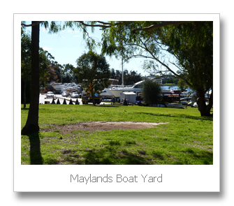
The walk up the river is on the north shore. The combined walking path and cycling track was excellent. The first part of the walk is around the Maylands Peninsula. The Peninsula at one stage was a brickworks and an airfield. Now it is a mixture of lovely housing and a golf course. It does amaze me the way we have abused the river area. We have either dug big clay pits or filled in natural wetlands with our rubbish. Fortunately we have had the wealth to turn the rubbish dump sites into nice parklands and golf courses, but these are not part of the natural environment. As I rounded the peninsula there is a remainder of one of the lights used to illuminate the old airfield. The airfield was used until 1963, when the new airport at Belmont was opened. Although the Belmont site had been used since the 1930s and by the 1960s Maylands was only used for light aircraft. Also on the peninsula is the Maylands boat building facilities. They are still quite extensive and look a little out of place in the middle of suburbia.

After about an hour and a half I was at Tranby House. This historic property is the 3rd farmhouse built on a farm first settled in the 1831. This is the oldest residential building in the Perth area. It was saved from developers to be turned into a heritage property and tea rooms. It really is in a very nice situation. This was about the halfway point of the walk. From here on the river in parts takes on a more natural appearance. There are also some beautiful properties with there own private jetties. One place had a big launch parked out the front, it looked rather unusual so far up the river. Fortunately the pathway mostly followed the river frontage. Occasionally I had to follow the roads inland. As I got closer to Guildford and the older parts of Perth there was reduced access to the river frontage. This would make sense as the early land allocation most likely wouldn’t have taken public access into account.
 |
| Just north of Graham Farmer Bridge East Perth |
 |
| Brickworks Maylands, closed c1980 |
Another historic site I passed on my walk was a Pensioner Guard House. Build around 1856. This house was provided to retired soldiers who were employed to guard convicts. Once again this is a rare survivor of an earlier era. I made may way across the Guildford Bridge and caught a train back to Claisebrook Station to collect my car. I had arrived in Guildford at about 4.45pm, with 30 minutes lost having afternoon at Tranby House. Therefore the walk took approximately 3 hours and 15 minutes.


 |
| Nike Zoom Equalon +4 |


No comments:
Post a Comment